Yes, stop. Whatever you’re doing (unless it’s open-heart surgery in which case what are you doing online you quack) stop it right now and just look at this.
It’s a new version of the high-resolution images of Pluto acquired by New Horizons on July 14, 2015, except here color data was added to create an enhanced-color view that’s simply INCREDIBLE!
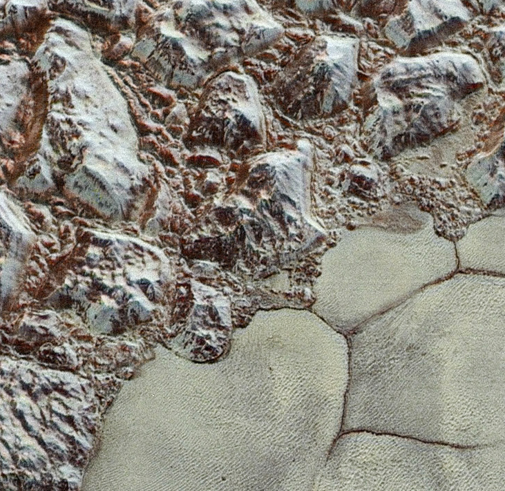
The region seen above shows the boundary between the frozen nitrogen plains of Sputnik Planum and the 1.5-mile-high peaks of the rugged Al-Idrisi mountains to the northwest. The area is about 50 miles (80 km) across, and it’s just a part of a much longer strip mosaic.
Not very long ago at all we could only imagine what the surface of Pluto might actually look like, and now we have images like these—with more on the way! It’s been quite a year for space exploration.
For a full-sized version of the entire image swath, click here.
The video below gives an idea as to where on Pluto this view is located:
Source: NASA/JHUAPL/SwRI

Thanks. Amazing what we can see today!!
LikeLike
Wow. Incredible. What does it mean to “add color data?” How do they get that data; why is it separate from the base image data?
LikeLike
So inspiring.
LikeLike